


(a) Draw an outline map of Nigeria. On the map, show and name;
(i) one area of sparse population;
(ii) one area of moderate population;
(iii) one area of dense population;
(iv) one town in (a)(i) above
(b) Outline three factors responsible for the dense population in the area shown in (a) (iii) above.
(c) Highlight three problems of dense populatiion in (a)(iii) above.
(a) Draw a sketch map of Africa. On the map, show and name the
(i) River Nile; (ii) River Niger; (iii) River Orange (iv) River Zambezi
(b) Describe four characteristics of African rivers
(c) Highlight three uses of African rivers
(a) Draw an outline map of Africa. On the map, show and name
(i) one area that receives rainfall in winter;
(ii) the dominant air masses over Africa in July;
(iii) the position of the ITCZ in July
(b) Explain the effects of altitude on the climate of Africa.
Study the map extract on a scale of 1:50,000 and answer the following questions:
(a) On the map, mark and name one example of each of the following features with the letters in bracket:
(i) Spur (SP);
(ii) Gentle slope (GS);
(iii) Watershed (WS);
(iv) V-shaped valley (VS).
(b) In your answer booklet;
(i) calculate the length (in km) of River Dakorobi from its source to the point where iL joins River Sencha. (Show all workings clearly);
(ii) describe the relief of the mapped area.
(c) Highlight the influence of relief on settlement in the area. P
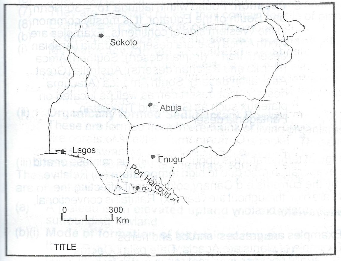
The Table below shows the volume of air passenger traffic between Lagos and four other cities in Nigeria in 1985. Study the table and use the data in it to answer the questions that follow:
| S/N | Route | No. of passengers |
| 1 | Lagos - Abuja | 500,000 |
| 2 | Lagos - Enugu | 200,000 |
| 3 | Lagos - Port Harcourt | 400,000 |
| 4 | Lagos - sokoto | 300,000 |
(a) Using the attached map of Nigeria - Map B, construct a flow map/chart to represent the data in Table 1.
(b) State two advantages cf representing data with flow maps.

